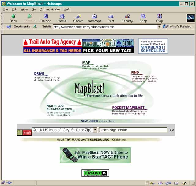
4. Open a new window in your web browser (Ctrl-N) and go to the MapBlast website. http://www.mapblast.com/mblast/ You can then type in the name of the town on the label (e.g. "Cutler Ridge, FL") in the search space shown on that page and hit "GO" to the right of the entry box.
NOTE: Tiger
is for US localities only but MapBlast no longer displays lat/long. We
are seeking alternatives but for the time being we are only doing US localities
and using Tiger.
The process is very similar on both servers.
5. The MapBlast engine will then show a map of that area (sometimes it will ask for clarification if more than one area of the same name exists). This is the most important step: you now click the radio button (the hole with a dot in it) below the map to "Moves Icon" and then place your mouse on the EXACT place that the specimen (the one you just looked up in the Virtual Herbarium) was collected, and click your mouse.
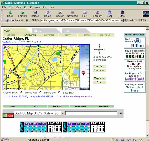
6. You will note that the icon (the little red cross) has moved to where you clicked your mouse on the previous screen. If it is correct for the locality on the specimen label then just type the BARCODE number from the specimen label followed by the latitude and Longitude indicated below the map into a text file. We recommend that you cut and paste these numbers using Crtl-C and Ctrl-V respectively. This avoids errors in transcription. If the locality is vague, place the icon in the middle of the area that you think it could be in.
7. Because some labels are more descriptive than others, it is necessary to estimate the accuracy of the location. For example, it is easy to get an exact lat/long for "the SE corner of US-1 and Red. Rd. in South Miami" but impossible to know the exact locality of a specimen that only says "Florida" on the label. The ranking system is as follows.
Note that if the State or County is indicated
in the data above the label, we have already determined those data for
the specimen, and you should make use of them even if they are not shown
on the label.
Notice also that you can Zoom in on the map and also change the size of the map. This will not change your data and you should customize your view to get the most accurate reading possible.
8. Finally, you should send your text file with 4 columns (Barcode, Latitude, Longitude, Precision) to Dr. Guala at Stinger@fiu.edu
Note that a few specimens do not have barcodes. For these you can use the Accession number (which will always be there) but be sure to indicate to us that you have used an accession number rather than the barcode.
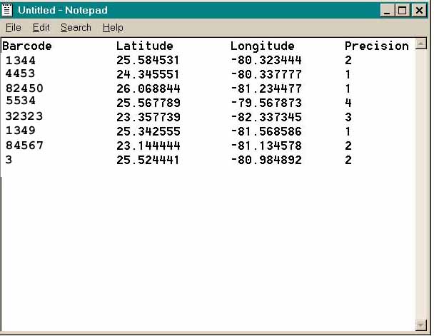
Note that longitudes are negative. In general notation, South latitudes and West longitudes are negative.
You can use any DOS/ASCII text editor (NOTEPAD comes with every windows system). Just copy (Ctrl-C) and paste (Ctrl-V) the data into your email. You can also use Excel and send it as an attached text file.
EVALUATION AND CREDIT
All work will be checked. We do this by putting your data into a mapping program and mapping it. If you have dots in the middle of the ocean or dots that don't match the given localities, your work will be rejected and you will not receive credit.
You will get credit for 6 specimens per hour for this project because we do not see you working at home, your time credit must be piecework based. You may only do 2 specimens per hour for the first hour but everyone eventually hits 6-9 specimens per hour and we have had one person reach 10/hr.
Credit will ONLY be given for discreet groups of specimens (usually
an entire genus) completed. If you agree to do an entire genus and only
finish 2/3 of it you will not get credit until it is finished. We will
give you a small one to start out and you can request larger ones as you
get faster and more confident.